Florida floods move north after historic rainfall
The National Weather Service warns of severe flash flooding as the St. Johns River rises above its 1953 record and emergency crews respond to trapped residents.
By Priya Marino ·
Persistent high pressure over Virginia and a low-pressure system in the Gulf have driven a steady onshore flow across the Florida Peninsula since Tuesday, producing more than 17 inches of rain in some areas. The weather pattern is linked to El Niño conditions that forecasters expect to persist through the spring.
The National Weather Service issued flood warnings and watches covering a 200-mile stretch from just south of Melbourne to Jacksonville. Forecasts predict 2 to 6 inches of additional rain through Saturday, with some locations potentially receiving up to a foot of water. Officials stated that areas which typically do not experience flash flooding are expected to be inundated, placing lives and property in great danger.
The St. Johns River, the state's longest waterway, rose above its record level set in 1953 near Cocoa on Thursday. The agency projected the river would remain at least two feet above flood stage through early next week. In response, nearly 200 Florida National Guard personnel with 50 high-water vehicles were deployed along the coast. Approximately 235 officers from the Florida Fish and Wildlife Conservation Commission also joined the response effort.
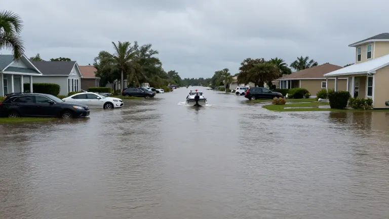
Rescue operations intensified in the Florida Shores neighborhood of Edgewater on Friday. Police officers waded through knee-deep water, towing a small boat to transport residents to higher ground. To the south in Brevard County, authorities used airboats to navigate flooded streets, continuing a response that included nearly 100 high-water rescues the previous day.
Sara Hernandez, a cleaning business owner in Cocoa, reported that water reached her front and back doors on Thursday morning. By Friday, several inches of water remained inside her home. She stated that she had never seen such volume in her 25 years in Florida and lacked funds to replace submerged appliances. Her family currently stays at her brother-in-law's house ahead of Thanksgiving.
Scott Kleebauer, a meteorologist at the Weather Prediction Center in Maryland, said the low-pressure system will move northeast to affect Georgia and the Carolinas during the weekend. A second Atlantic system is expected to bring rain from the mid-Atlantic to New England on Sunday and Monday, potentially developing into a subtropical or tropical storm. Kleebauer noted that a third system may form midweek, with the potential to impact travel on Wednesday and Thanksgiving Day.
Preliminary data indicates several places in Florida have recorded their wettest November on record. The rainfall arrives after heavy storms earlier in the month, compounding the impact on the state's east coast. Meanwhile, coastal Highway 1 in California remained closed south of the Monterey Peninsula due to rock and mud slides.